UPDATE (3pm): The Met Office has issued an Adverse Weather Alert for sixteen (16) hours this weekend as more bad weather is expected for T&T.
UPDATE (1pm): Showers and Thunderstorms are approaching Northern and Eastern Trinidad, as well as Tobago. Street/Flash Flooding is possible.
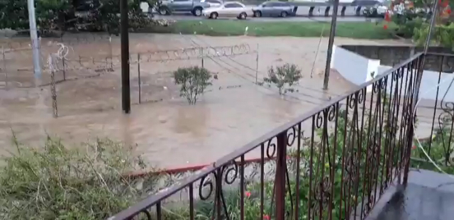
As periods of showers and Thunderstorms continue to affect southern areas of Trinidad, the Trinidad and Tobago Meteorological Service has advised that this activity is expected to gradually spread to other parts of T&T as the day progresses.
See the Weather Forecast below from the Met Office for Saturday 27th July 2019 and stay tuned for updates. Increasingly cloudy with periods of showers and or rain over broad areas. There is a medium to high chance (40% to 80%) some of these showers could become heavy and or thundery and accompanied by gusty winds. Conditions should continue into night fall. In the vicinity of heavy showers/thunder showers, expect Street/Flash flooding and gusty winds. 
0 Comments
Leave a Reply. |
AboutYouthere1 is a website focused on providing useful information, breaking news, entertainment and online shopping in Trinidad and Tobago.
AlertsSupportYouTubeContactPrivacyCategories
All
Archives
May 2024
|
 RSS Feed
