 According to the Water and Sewerage Authority (WASA), heavy rainfall associated with the Inter-Tropical Convergence Zone (ITCZ) has impacted operations at some of its Surface Water Treatment facilities in North Trinidad.
In an Adverse Weather Impact Status update this afternoon (Thursday 27th October 2022), WASA notes that river conditions are continually being assessed and works have commenced at some facilities. The following Water Treatment Plants (WTPs) are experiencing reduced production or have been stopped due to high turbidity as a result of flooded river conditions:
The Authority said it will continue to provide updates, “as every effort is being made to return these facilities to service at the earliest possible time.”
0 Comments

The Trinidad and Tobago Meteorological Service (TTMS) has just upgraded its Adverse Weather Alert from Yellow Level to Orange Level. The Alert remains in effect until 3:00 PM on Saturday (29th October 2022).
According to the Met Office, the Inter-Tropical Convergence Zone (ITCZ) continues to affect Trinidad and Tobago and a Tropical Wave is also expected on Friday (28th October 2022). Prolonged periods of rain and intense showers are expected overnight into Friday morning, with a high (80%) chance of thunderstorm activity. Rainfall in excess of 75mm can result.
Gusty winds in excess of 55 Km/h may be experienced especially in the vicinity of heavy showers/thunderstorms. Street/flash flooding and localized flooding are also likely. Seas can become agitated at times in sheltered areas and landslides/landslips are also possible in areas so prone.
Persons are advised to not wade or drive through flood waters. Secure loose outdoor items and livestock. Monitor weather conditions and river levels. This is a developing story - refresh this page for updates. 
The Ministry of Rural Development and Local Government (RDLG) is advising that the upper Caroni River at El Carmen is at 80% capacity as at 2:30 PM this afternoon (Thursday 27th October 2022). More rainfall is forecast across Trinidad and Tobago over the next thirty-six (36) hours. All Government Agencies remain on alert.
Below are the various river capacities as at 2:30 PM:
The Cipero River at Gulf View neared threshold at 1:30 PM this afternoon. The Ministry warns that elevated river levels may result in spillage into communities. The public is urged to take caution and affected communities are urged to call the relevant Disaster Management Units (DMUs). High Tides will result in slower water run-off.
An Adverse Weather Alert (Yellow Level) remains in effect until 3:00 PM on Saturday (29th October 2022).
This is a developing story - refresh this page for updates. 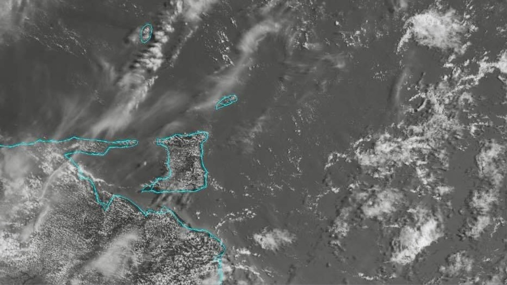 In a Media Release today (Thursday 27th October 2022), the Ministry of Finance said it is now in receipt of the final figures for the actual revenue collections in Fiscal 2022, up to the end of September 2022.
According to the Ministry, “At the time of the presentation of the 2023 Budget on September 26, 2022, the revenue figures for Fiscal 2022 were based on actual figures, from October 1, 2021 to August 31, 2022, and estimated figures for the month of September 2022. However, the Board of Inland Revenue has since finalized the actual revenue figures for Fiscal 2022 and it has been determined that the total revenue in Fiscal 2022 was $54.21 billion, which is $2.57 billion more than the revised estimate announced in September 2022, and $10.88 billion more than the original revenue estimate of $43.33 billion for Fiscal 2022, made in October 2021.” “With total expenditure for Fiscal 2022 now estimated at $54.54 billion, the fiscal deficit for 2022 is now estimated at $329 million, which is less than 0.2% of GDP, well below the international benchmark for fiscal deficits of 3% of GDP,” the Ministry added. The Media Release concluded by saying, “In essence, we have achieved an almost balanced national budget in Fiscal 2022, something that has not occurred in Trinidad and Tobago since 2008, 14 years ago.”  A female Police Officer attached to the Maloney Police Station was killed in a crash on the Sir Solomon Hochoy Highway near the Harmony Hall Overpass on Wednesday night (26th October 2022). She has been identified as WPC Susan Duncan-Thomas.
According to reports, a vehicle crossed the median on the Southbound lane of the Highway and collided with the vehicle driven by WPC Duncan-Thomas, who was on the Northbound lane. The location where the vehicle crossed from the Southbound lane has been an area of multiple fatal crashes over the years. WPC Duncan-Thomas worked in the Court and Process Section in Port-of-Spain and at the Mounted Branch. [Source: Trinidad Express] 
The Ministry of Rural Development and Local Government (RDLG) is informing the public of the following in light of an approaching weather system which is expected to affect Trinidad and Tobago in the coming days:
1. Trinidad and Tobago Meteorological Service (TTMS) issued a Weather Alert - Yellow Status on Tuesday 25th October 2022. 2. On the weather system's present course, the Weather Alert - Yellow Status is currently in effect until Saturday 29th October 2022. 3. TTMS has forecasted unstable weather conditions for several days ahead including periods of heavy rainfall with strong, gusty winds in excess of 55 Km/hr, resulting in river and riverine breaches.
4. With days of rainfall, the soil will be heavily soaked thereby providing greater risk of landslides and the like.
5. With the weather pattern including flash flood risks, all persons who reside in flood-prone areas are exposed to the usual risks and damage from the effects of the weather and must: (i) take all necessary precautions including identification of risks which should be reported to Disaster Management Units (DMUs) numbers below and (ii) seek to protect their property and belongings by elevation and through the use of sandbags, etc., which are available at the Municipal Corporations. 6. All Government Agencies are on alert through the co-ordination of the Ministry of Rural Development and Local Government (RDLG), as well as through RDLG's DMUs to all fourteen (14) Municipal Corporations. 7. RDLG co-ordinated with the Office of Disaster Preparedness and Management (ODPM), WASA, T&TEC, Trinidad and Tobago Defense Force, Trinidad and Tobago Municipal Police Service, National Quarries Company Limited and SWMCOL. 8. The RDLG is deeply concerned by reports of protests and evidence of wilful sabotage by the cutting of trees which are staged to fall on cables and lines. These wilful criminal actions are resulting in unwarranted flooding and delays in the delivery of relief for affected communities. Persons are asked to contact their relevant DMU for ”See Something, Say Something,” to prevent further risk to life and property. The Trinidad and Tobago Police Service (TTPS) and the Municipal Police are actively on patrol and are fully deployed. 9. Reports of flash flooding in areas have been received and the relevant bodies have been deployed to address accordingly. 10. Take note that tide is currently raising as high tide is at 4:45 PM, and this will result in delayed run-off of flash floods. 11. The public is asked to exercise extreme precaution on roadways and avoid torrential flood waters if they occur. 12. Sandbags are available for collection through the DMUs of all fourteen (14) Corporations. 13. Affected communities as asked to contact the relevant DMU hotline. 14. Please see below for DMU hotline listing:
This is a developing story - refresh this page for updates. 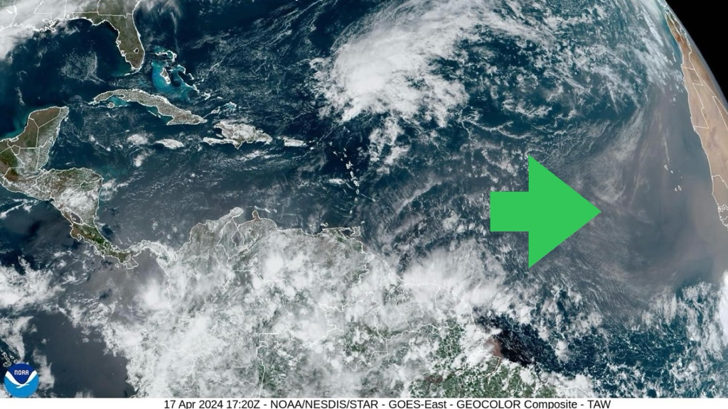
In an update at 4:10 PM this afternoon (12th October 2022), the Trinidad and Tobago Meteorological Service (TTMS) said the current Adverse Weather Alert (Yellow Level) remains in effect until 3:00 PM on Saturday (29th October 2022).
According to the Met Office, the Inter-Tropical Convergence Zone (ITCZ) is expected to drift over T&T tonight, followed by a Tropical Wave on Friday (28th October 2022). Periods of rain and/or showers of varying intensities are expected, with a high (80%) chance of heavy showers and thunderstorms that can produce intense rainfall in excess of 50mm.
Gusty winds in excess of 55 Km/h may be experienced especially in the vicinity of heavy showers/thunderstorms. Street/flash flooding and localized ponding are also likely in heavy downpours. Seas can become agitated at times in sheltered areas and landslides/landslips are also possible in areas so prone.
Persons are advised to not wade or drive through flood waters. Secure loose outdoor items and livestock. Monitor weather conditions and river levels. This is a developing story - refresh this page for updates.  Clorox has recalled approximately 37 million bottles of Pine-Sol products because they could contain a potentially harmful bacteria. According to Clorox, some of the affected Pine-Sol products might contain a bacteria called Pseudomonas Aeruginosa, which can harm people with compromised immune systems or people with external medical devices. This is because they pose ”a risk of serious infection that may require medical treatment," according to the Consumer Product Safety Commission (CPSC).
Eight (8) different versions of Pine-Sol have been recalled in the United States, including Pine-Sol scented multi-surface cleaners (lavender clean, sparkling wave and lemon fresh scents), CloroxPro Pine-Sol all purpose cleaners (lavender clean, sparkling wave, lemon fresh, and orange energy scents) and Clorox Professional Pine-Sol lemon fresh cleaner. No injuries have been reported so far, according to the CPSC. The affected Pine-Sol products were made between January 2021 and September 2022. The described products were made at Clorox's factory at Forest Park, Georgia. They were sold on Amazon and at several national retailers in the U.S. such as Walmart, Target, Sam's Club, Kroger and Dollar Tree. Recalled bottles have date codes beginning with the prefix ”A4” followed by a five-digit number less than 22249. The products are sold in bottles of varying ounces, ranging from 28- to 175-fluid ounces. If someone has a recalled Pine-Sol bottle, the CPSC advises it be thrown away and for Pine-Sol to be contacted for a refund. [Source: CNN Business]  A 28-year-old Venezuelan woman has been charged with eight (8) counts after allegedly assaulting two (2) Police Officers during a traffic stop in Arima on Tuesday (25th October 2022). According to Police, the woman, identified as Daniela Yoliani Nunez Vallejo of Aquamarine Crescent, Union Hall, San Fernando, cursed and kicked PCs Jason Phillip and Winston Jack, both assigned to the Arima Police Station Traffic Unit. The incident occurred around 10:00 AM on Tuesday while the Officers were on patrol on Pro Queen Street. They observed the woman’s car, a Chevrolet Aveo, parked in a no-parking zone and PC Jack approached her. She was informed by the Officer that she was parked illegally. On checking her documents, PC Jack realized they were fake, and while trying to arrest her, she allegedly pulled away her arm in a violent manner. The woman then allegedly kicked PC Jack in the groin while holding on to the steering wheel of the car. Vallejo is then alleged to have scratched PC Phillip with her fingernail while calling him a “f--king animal” and threatening his family. Vallejo was taken to the Arima Police Station, where she was charged with assaulting both Officers, obscene language, resisting arrest, driving without a valid certificate of insurance, driving without a driver’s permit, breaching a traffic sign and disorderly behaviour. The Officers later sought medical attention at the Arima Health Facility and obtained medical certificates, detailing their injuries. A passer-by recorded the incident and shared it on social media. The video showed an Officer trying to pull a woman out of a red car as she argued with them. Those looking on are heard calling on the Officers to get a female Officer instead to arrest the woman. At one point the woman is seen kicking an Officer who held on to her foot. The Officers eventually get the woman out of the car after another man tells the woman to calm down.
The video ends with a man being arrested after an Officer accuses him of using obscene language. [Source: Newsday]  A Media Release today (Wednesday 26th October 2022) from the Office of the Prime Minister - Communications Division, states that, “Members of the public are advised that a video is being circulated on various social media platforms, referencing a weather pattern designated 98L. This is a video from September 22nd 2022.”
The statement notes that the current situation, as advised by the Trinidad and Tobago Meteorological Service (TTMS), refers to an Inter-Tropical Convergence Zone (ITCZ) for T&T and the Windward Islands as Adverse Weather Alert #2 remains in effect. The forecast from the Met Office for this afternoon and tonight calls for partly cloudy to cloudy conditions with occasional showers and extended periods of light rain. There is a 70% (high) chance of a few heavy showers and thunderstorms mainly during the afternoon and overnight. Gusts and street/flash flooding are likely in heavy downpours. The Government Communications Division added, “All citizens are encouraged to be vigilant and to be aware of the risk of showers, thundershowers and the possibility of flash and street flooding, especially in areas prone to this. Reach out to your Regional Corporations, your Local Government Councilors and Disaster Management Units as needed.” The Media Release concluded by saying, “The public is asked to refrain from sharing and re-sharing this video and to get updates on weather conditions from official sources only, such as the Trinidad & Tobago Meteorological Service (TTMS), the office of Disaster Preparedness and Management (ODPM), the Ministry of Rural Development and Local Government (MRDLG) and the Tobago Emergency Management Agency (TEMA).” |
AboutYouthere1 is a website focused on providing useful information, breaking news, entertainment and online shopping in Trinidad and Tobago.
AlertsSupportYouTubeContactPrivacyCategories
All
Archives
May 2024
|
 RSS Feed
