
According to the Trinidad and Tobago Meteorological Service (TTMS), an early start to the Wet Season is expected in the second half of May 2024, with May having a high chance for above-normal rainfall.
Mostly near-normal rainfall is expected for the April to June (AMJ) 2024 period, with a moderate potential for flooding. Largest rainfall accumulated totals for AMJ are likely to be as high as 728mm in areas such as North Oropouche, Valencia, Sangre Grande and Plum Mitan in Northeast and East Trinidad; and near 482mm in Goodwood, Charlotteville and environs in Northeast Tobago. The Met Office notes that a few small wetter than usual pockets are likely to occur over Central and Southern Trinidad during AMJ.
The Atlantic Hurricane Season begins on 1st June, 2024 and runs until 30th November, 2024, with most activity occurring between mid-August and mid-October. Forecasters are already predicting that this year’s Hurricane Season could be particularly active.
Although it is too early for any models to offer an official prediction — the National Oceanic and Atmospheric Administration (NOAA) would not issue a forecast until 23rd May, 2024 — experts are warning that warm sea surface temperatures in the Atlantic and the development of a La Niña in the Pacific, may create a “perfect storm” of the conditions needed for major Hurricanes to form. See the latest Rainfall and Temperature Outlook for Trinidad and Tobago here.
0 Comments
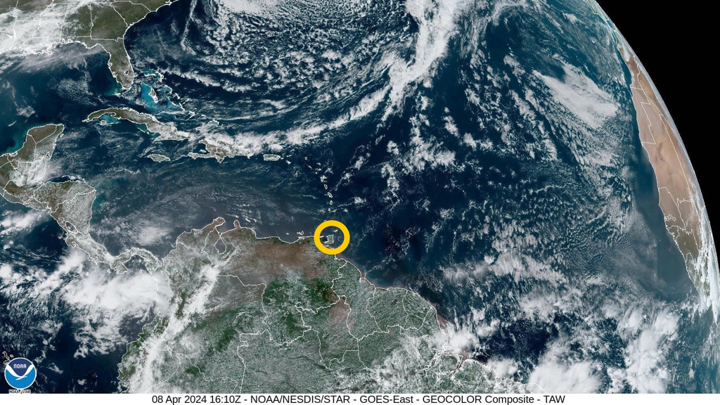 According to the Trinidad and Tobago Meteorological Service (TTMS), a shear-line across the Leeward Islands on Tuesday (9th April, 2024), associated with the dissipating end of a frontal system to the Northeast, is expected to bring some partly cloudy to cloudy periods with light or moderate showers over varying areas, and the chance of an isolated heavy shower. Continuing surface convergence and moisture advection across the Leeward Islands for most of the outlook period is likely to show an increase in showers and higher probabilities for heavy showers or isolated thunderstorm development from the evening of Friday (12th April, 2024) to Sunday (14th April, 2024).
Dominant high pressure over the equatorial North Atlantic and ridging are the main synoptic features across Trinidad and Tobago and the Windward Islands. On the synoptic scale, rainfall accumulation possible across the Leeward Islands are, at this time, roughly estimated to be one (1) to two (2) inches, over the next five (5) to ten (10) days. No major precipitation-causing event or significant rainfall accumulation is predicted for the Windward Islands, which remain relatively dryer in comparison, throughout the outlook period. Generally fair and sunny conditions are expected across Trinidad and Tobago and the Windward Islands for this outlook period. A few intermittent patches of moisture advection are likely to produce brief showers over varying areas, and at times when there is interaction with the local topography and daytime land heating, there is still a chance for an isolated, moderate or heavy shower to develop, favouring hilly areas mainly during the late mornings to afternoons. The surface to mid-level (approx. 8,000 ft) synoptic wind-field across Trinidad and Tobago and the Windward Islands is likely to show a relative increase in speed from Thursday (11th April, 2024) to Saturday (13th April, 2024). Breezy to, at times windy conditions are likely, especially in elevated areas or in the vicinity of any shower which might occur. Although this could provide some ventilation, the maximum daytime temperatures can still get up into the mid-thirties of degrees Celsius on some days. Saharan dust concentration in the atmosphere will be mostly mild until Wednesday (10th April, 2024), when concentrations are expected to become moderate at times, for the remainder of this outlook period. The Met Office notes that that we are still in the Dry Season and the probability for bush and brush fires, together with the possibility for landfill and forest fires, remain elevated. These are likely to continue to contribute to the reduction in air quality at times. Sensitive persons are still advised to take precautions as necessary. An increase in wave heights in open waters and swell periods from Thursday (11th April, 2024) could produce the occasional energetic wave coming unto the shore. The Met Office advises to always take the necessary precautions in any marine activities. Please continue to pay attention to the latest forecasts, alerts, and information issued by the TTMS. 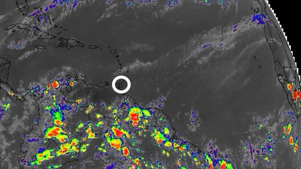 According to the Trinidad and Tobago Meteorological Service (TTMS), the high pressure cell has been re-established over the North Atlantic and the atmosphere returns to a more general ridging pattern across the Lesser Antilles.
On the synoptic scale, no major precipitation-causing event or significant rainfall accumulation is predicted for the Lesser Antilles during this outlook period (Thursday 4th to Sunday 7th April, 2024). However, with some low-level convergence and intermittent patches of moisture advection interacting with the local topographies, there is likely to be a few brief, light or moderate showers and possibly an isolated heavy shower, especially near hilly areas. Generally fair and sunny conditions are expected across Trinidad and Tobago for the remainder of the outlook period. A few partly cloudy periods, producing brief showers, are likely at times when there are intermittent patches of moisture advection interacting with the local topography and daytime land heating. There is still a chance for an isolated, moderate or heavy, shower to develop, favouring hilly areas mainly during the late mornings to afternoons. The surface to mid-level (approx. 10,000 ft) synoptic wind-field across Trinidad and Tobago and the Windward Islands is beginning to show an increase in speed, being moderate to strong in the near-surface to mid-level (approx. 1,500 ft – 8,000 ft), especially this Friday (5th April, 2024) and Saturday (6th April, 2024). Breezy to at times windy conditions are likely, especially in elevated areas or in the vicinity of any shower which might occur. Although this could provide some much needed ventilation, the maximum daytime temperatures can still get up into the mid-thirties of degrees Celsius on some days. Saharan dust concentration in the atmosphere is mostly mild until Friday (5th April, 2024) when there is expected to be an increase to mostly moderate concentrations for the remainder of this outlook period. The Met Office notes that we are still in the Dry Season, and as the atmosphere begins to subsequently dry out once more, the probability for bush and brush fires, together with the possibility for landfill and forest fires, will again begin to rise. These are likely to continue to contribute to the reduction in air quality at times. Sensitive persons are still advised to take the precautions as necessary. All marine interests are being advised to exercise caution, particularly along the Northern and Northeastern coastal areas, due to the possibility of occasional long period swells. A Hazardous Seas Alert (Yellow Level) will be in effect from 8:00 AM on Friday morning (5th April, 2024) until 2:00 PM on Tuesday afternoon (9th April, 2024). Please continue to pay attention to the latest forecasts, alerts, and information issued by the TTMS. 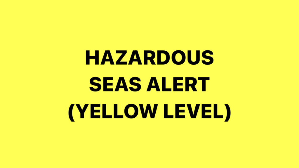
The Trinidad and Tobago Meteorological Service (TTMS) has issued a Hazardous Seas Alert (Yellow Level) for Northern and Eastern coastlines of Trinidad and Tobago. The Alert begins at 8:00 AM on Friday morning (5th April, 2024) and will remain in effect until 2:00 PM on Tuesday afternoon (9th April, 2024).
According to the Met Office, long period swells are likely to coincide with Spring Tides as well as a surge of low-level winds. This can result in choppy sea conditions and battering waves at coastal regions, which can be exacerbated during High Tides. Marine interests, mainly near-shore activities, including fishing, sea-bathing and small craft mooring can be adversely affected.
All marine interests should monitor sea conditions and exercise caution. Limit marine activities where possible. Fisher-folk are advised to take the necessary precautions in securing their vessels.
Please continue to pay attention to the latest forecasts, alerts, and information issued by the TTMS. This is a developing story - refresh this page for updates.  According to the Trinidad and Tobago Meteorological Service (TTMS), a team of highly skilled engineers from LEONARDO (German Radar Manufacturing Company) has arrived in Trinidad and Tobago to commence repair works on its Doppler Weather Radar. This collaborative effort aims to restore the full functionality of the radar system, ensuring accurate and reliable weather forecasting capabilities for the nation.
In a Media Release today (Thursday 4th April, 2024), the Met Office said, “Following recent technical issues encountered by the TTMS Doppler Weather Radar, the Honourable Marvin Gonzales, Minister of Public Utilities, Government of the Republic of Trinidad and Tobago, promptly engaged with LEONARDO, a renowned leader in radar technology solutions, to provide specialized expertise for the repair and maintenance of the radar infrastructure.” The TTMS added, “The team of engineers from LEONARDO brings extensive experience and technical proficiency in radar systems, equipped with the latest tools and resources necessary to diagnose and address the issues affecting the TTMS Doppler Weather Radar. Their arrival marks a significant milestone in our efforts to enhance the resilience of Trinidad and Tobago's Meteorological Service. We extend our gratitude to LEONARDO for their prompt response and collaborative partnership in addressing this critical matter. Their commitment to excellence aligns with our shared vision of safeguarding the well-being and safety of the citizens of Trinidad and Tobago through advanced weather monitoring and forecasting capabilities.” The Media Release concluded by saying, “The repair works are expected to commence immediately, and every effort will be made to expedite the process while ensuring the highest standards of quality and reliability. We will continue to provide updates on the progress of the repair works as they unfold.” More on this as it becomes available. 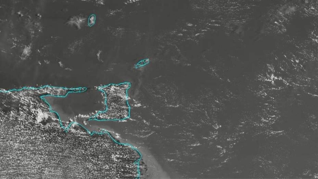 According to the Trinidad and Tobago Meteorological Service (TTMS), we can expect generally sunny, slightly hazy and breezy conditions today (Thursday 4th April, 2024), despite a few partly cloudy intervals with isolated showers. Tonight will be mostly fair but hazy with a few brief isolated showers.
The Met Office notes that a gradual increase in concentration of Saharan dust is expected as the day progresses. Persons sensitive to these changes in atmospheric quality should take the necessary precautions. The forecast maximum temperature today will be 33°C at Piarco in Trinidad and 32°C at Crown Point in Tobago. Seas are moderate with waves 1.5m to 2m in open waters and below 1m in sheltered areas. Please continue to pay attention to the latest forecasts, alerts, and information issued by the TTMS. 
According to the Trinidad and Tobago Meteorological Service (TTMS), mostly near-normal rainfall is expected for the April to June period, with a moderate potential for flooding. Largest rainfall accumulated totals for April to June (AMJ) 2024 are likely to be as high as 728mm in areas such as North Oropouche, Valencia, Sangre Grande and Plum Mitan in Northeast and East Trinidad; and near 482mm in Goodwood, Charlotteville and environs in Northeast Tobago.
Key Messages:
Likely Impacts:
The Met Office also notes the following:
The temperature outlook favours above-normal temperatures for April to June 2024:
Climatic influencers and context of the outlook:
Please continue to pay attention to the latest forecasts, alerts, and information issued by the TTMS. [Source: TTMS]  The Office of Disaster Preparedness and Management (ODPM) is advising the traveling public that there have been reports of a fallen tree along the North Coast Road, in the vicinity of Maracas Lookout, blocking both lanes. Commuters are advised to use any available alternative routes.
First responders are aware of the situation and are mobilizing to remove the debris. The public is advised to follow official sources for additional information and updates. Persons interested in signing-up to the Public Alert Notification System (PANS) can do so via this link: https://member.everbridge.net/2388693306310661/new. More on this as it becomes available. This is a developing story - refresh this page for updates.  According to the Trinidad and Tobago Meteorological Service (TTMS), we can expect partly cloudy conditions today (Wednesday 3rd April, 2024), with a few scattered showers/rain over broad areas. There is a low to medium (30% to 60%) chance that some of these showers could become heavy and/or thundery. There conditions are expected to improve gradually as the day progresses. Tonight will be fair to partly cloudy at times with a few lingering isolated showers.
The Met Office notes that we can expect gusty winds, street and/or flash flooding in the vicinity of heavy showers/thunderstorms. The forecast maximum temperature today will be 32°C at Piarco in Trinidad and 31°C at Crown Point in Tobago. Seas are moderate with waves up to 2m in open waters and below 1m in sheltered areas. Please continue to pay attention to the latest forecasts, alerts, and information issued by the TTMS.  According to the Trinidad and Tobago Meteorological Service (TTMS), a passing perturbation across the Windward and Southern Leeward Islands, with associated low-level wind convergence and increased moisture advection, together with some enhancement from a generally Southwesterly flow in the upper atmosphere, are the main factors in the production of precipitation today (Tuesday 2nd April, 2024) and tomorrow (Wednesday 3rd April, 2024). From Thursday (4th April, 2024), the atmosphere returns to a more general ridging pattern across the Lesser Antilles.
On the synoptic scale, no major precipitation-causing event or significant rainfall accumulation is predicted for the Lesser Antilles, but with some low-level convergence and intermittent patches of moisture advection interacting with the local topographies, there is likely to be a few brief, light or moderate showers and possibly an isolated heavy shower, especially near hilly areas. From Thursday (4th April, 2024), generally fair and sunny conditions are expected across Trinidad and Tobago for the remainder of the outlook period, except for a few showers at times when there are intermittent patches of moisture advection interacting with the local topography and daytime land heating. There is still a chance for an isolated, moderate to heavy shower to develop, favouring hilly areas during the late mornings to afternoons. The surface and near-surface synoptic wind-field across Trinidad and Tobago and the Windward Islands is expected to show a relative increase in speed during this outlook period. Breezy, to at times windy conditions are likely, especially in elevated areas or in the vicinity of any shower which might occur. Although this could provide some much needed ventilation, the maximum daytime temperatures are still expected to get up into the mid-thirties of degrees Celsius on some days. Saharan dust concentration in the atmosphere will be mostly mild until Friday (5th April, 2024), when there is expected to be an increase to mostly moderate concentrations for the remainder of this outlook period. Although analysis is indicating elevated levels of moisture and increased precipitation during today (Tuesday 2nd April, 2024) and tomorrow (Wednesday 3rd April, 2024), it is to be noted that we are still in the Dry Season, and as the atmosphere begins to subsequently dry out once more, the probability for bush and brush fires, together with the possibility for landfill and forest fires, will again begin to rise. These are likely to continue to contribute to the reduction in the air quality at times. Sensitive persons are still advised to take the precautions as necessary. The Met Office has provided the following 5-day weather outlook for T&T: Wednesday (3rd April, 2024)
Thursday (4th April, 2024)
Friday (5th April, 2024)
Saturday (6th April, 2024)
Sunday (7th April, 2024)
Please continue to pay attention to the latest forecasts, alerts, and information issued by the TTMS. |
AboutYouthere1 is a website focused on providing useful information, breaking news, entertainment and online shopping in Trinidad and Tobago.
AlertsSupportYouTubeContactPrivacyCategories
All
Archives
March 2024
|
 RSS Feed
