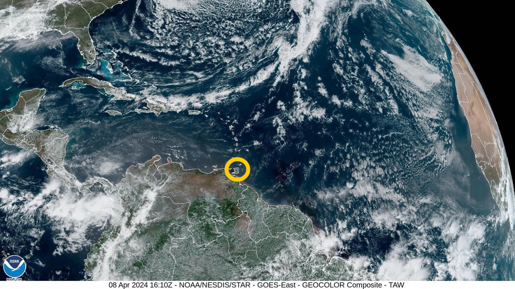
 According to the Trinidad and Tobago Meteorological Service (TTMS), a shear-line across the Leeward Islands on Tuesday (9th April, 2024), associated with the dissipating end of a frontal system to the Northeast, is expected to bring some partly cloudy to cloudy periods with light or moderate showers over varying areas, and the chance of an isolated heavy shower. Continuing surface convergence and moisture advection across the Leeward Islands for most of the outlook period is likely to show an increase in showers and higher probabilities for heavy showers or isolated thunderstorm development from the evening of Friday (12th April, 2024) to Sunday (14th April, 2024).
Dominant high pressure over the equatorial North Atlantic and ridging are the main synoptic features across Trinidad and Tobago and the Windward Islands. On the synoptic scale, rainfall accumulation possible across the Leeward Islands are, at this time, roughly estimated to be one (1) to two (2) inches, over the next five (5) to ten (10) days. No major precipitation-causing event or significant rainfall accumulation is predicted for the Windward Islands, which remain relatively dryer in comparison, throughout the outlook period. Generally fair and sunny conditions are expected across Trinidad and Tobago and the Windward Islands for this outlook period. A few intermittent patches of moisture advection are likely to produce brief showers over varying areas, and at times when there is interaction with the local topography and daytime land heating, there is still a chance for an isolated, moderate or heavy shower to develop, favouring hilly areas mainly during the late mornings to afternoons. The surface to mid-level (approx. 8,000 ft) synoptic wind-field across Trinidad and Tobago and the Windward Islands is likely to show a relative increase in speed from Thursday (11th April, 2024) to Saturday (13th April, 2024). Breezy to, at times windy conditions are likely, especially in elevated areas or in the vicinity of any shower which might occur. Although this could provide some ventilation, the maximum daytime temperatures can still get up into the mid-thirties of degrees Celsius on some days. Saharan dust concentration in the atmosphere will be mostly mild until Wednesday (10th April, 2024), when concentrations are expected to become moderate at times, for the remainder of this outlook period. The Met Office notes that that we are still in the Dry Season and the probability for bush and brush fires, together with the possibility for landfill and forest fires, remain elevated. These are likely to continue to contribute to the reduction in air quality at times. Sensitive persons are still advised to take precautions as necessary. An increase in wave heights in open waters and swell periods from Thursday (11th April, 2024) could produce the occasional energetic wave coming unto the shore. The Met Office advises to always take the necessary precautions in any marine activities. Please continue to pay attention to the latest forecasts, alerts, and information issued by the TTMS.
0 Comments
Leave a Reply. |
AboutYouthere1 is a website focused on providing useful information, breaking news, entertainment and online shopping in Trinidad and Tobago.
AlertsSupportYouTubeContactPrivacyCategories
All
Archives
March 2024
|
 RSS Feed
