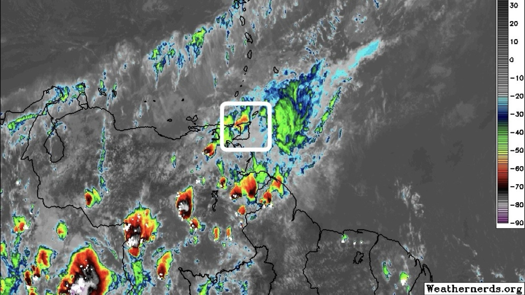
 According to the Trinidad and Tobago Meteorological Service (TTMS), a passing perturbation across the Windward and Southern Leeward Islands, with associated low-level wind convergence and increased moisture advection, together with some enhancement from a generally Southwesterly flow in the upper atmosphere, are the main factors in the production of precipitation today (Tuesday 2nd April, 2024) and tomorrow (Wednesday 3rd April, 2024). From Thursday (4th April, 2024), the atmosphere returns to a more general ridging pattern across the Lesser Antilles.
On the synoptic scale, no major precipitation-causing event or significant rainfall accumulation is predicted for the Lesser Antilles, but with some low-level convergence and intermittent patches of moisture advection interacting with the local topographies, there is likely to be a few brief, light or moderate showers and possibly an isolated heavy shower, especially near hilly areas. From Thursday (4th April, 2024), generally fair and sunny conditions are expected across Trinidad and Tobago for the remainder of the outlook period, except for a few showers at times when there are intermittent patches of moisture advection interacting with the local topography and daytime land heating. There is still a chance for an isolated, moderate to heavy shower to develop, favouring hilly areas during the late mornings to afternoons. The surface and near-surface synoptic wind-field across Trinidad and Tobago and the Windward Islands is expected to show a relative increase in speed during this outlook period. Breezy, to at times windy conditions are likely, especially in elevated areas or in the vicinity of any shower which might occur. Although this could provide some much needed ventilation, the maximum daytime temperatures are still expected to get up into the mid-thirties of degrees Celsius on some days. Saharan dust concentration in the atmosphere will be mostly mild until Friday (5th April, 2024), when there is expected to be an increase to mostly moderate concentrations for the remainder of this outlook period. Although analysis is indicating elevated levels of moisture and increased precipitation during today (Tuesday 2nd April, 2024) and tomorrow (Wednesday 3rd April, 2024), it is to be noted that we are still in the Dry Season, and as the atmosphere begins to subsequently dry out once more, the probability for bush and brush fires, together with the possibility for landfill and forest fires, will again begin to rise. These are likely to continue to contribute to the reduction in the air quality at times. Sensitive persons are still advised to take the precautions as necessary. The Met Office has provided the following 5-day weather outlook for T&T: Wednesday (3rd April, 2024)
Thursday (4th April, 2024)
Friday (5th April, 2024)
Saturday (6th April, 2024)
Sunday (7th April, 2024)
Please continue to pay attention to the latest forecasts, alerts, and information issued by the TTMS.
0 Comments
Leave a Reply. |
AboutYouthere1 is a website focused on providing useful information, breaking news, entertainment and online shopping in Trinidad and Tobago.
AlertsSupportYouTubeContactPrivacyCategories
All
Archives
March 2024
|
 RSS Feed
