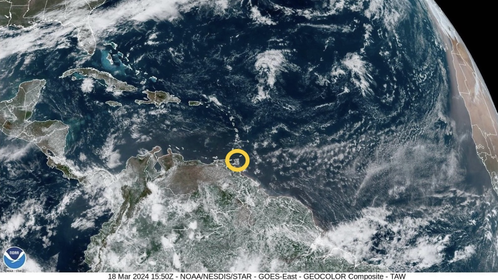
 According to the Trinidad and Tobago Meteorological Service (TTMS), over the past forty-eight (48) hours, a weak surface trough would have caused some convergence, and together with some moisture advection, produced a few showers in varying areas. The ridging pattern, together with a long and straight fetch across the Equatorial Atlantic, the Lesser Antilles and Trinidad and Tobago, continue to be the dominant feature.
Conditions are likely to be breezy, or windy at times, in some areas. Surface wind speeds are expected to be steady and generally moderate. The near-surface wind speeds (2,000 ft to approx. 8,000 ft) are expected to be moderate to strong, during this outlook period. Mostly fair, sunny, breezy and at times windy conditions, are expected across Trinidad and Tobago for this outlook period. Intermittent patches of moisture advection, together with some surface convergence, or a weak perturbation, interacting with the local topography, is likely to produce brief, light or moderate showers over varying areas, with a chance for an isolated heavy shower to occur, mainly near hilly areas. On the synoptic scale, no major precipitation-causing event or significant rainfall accumulation is predicted for Trinidad and Tobago and the Lesser Antilles, but on Thursday (21st March, 2024) to Friday (22nd March, 2024), a passing frontal system to the North and Northeast, could induce a weak perturbation, which is likely to result in a relative increase in moisture convergence over the area. There is the possibility for an isolated, moderate or heavy shower to develop, especially near hilly areas. The winds are likely to be breezy and windy at times, especially in elevated areas and in the vicinity of any shower that might occur. Seas in the open waters and near-shore areas, East of Trinidad and Tobago and the Windward Islands, will probably become choppy at times due to the steady surface winds across the Equatorial Atlantic. The Met Office notes that Saharan dust concentration in the atmosphere is expected to be mild, becoming moderate at times during this outlook period. Bush and brush fires, together with the possibility for landfill and forest fires, will likely contribute to the reduction in the air quality. Sensitive persons are still advised to continue to take the necessary precautions. The Met Office has provided the following 5-day weather outlook for T&T: Tuesday (19th March, 2024)
Wednesday (20th March, 2024)
Thursday (21st March, 2024)
Friday (22nd March, 2024)
Saturday (23rd March, 2024)
Please continue to pay attention to the latest forecasts, alerts, and information issued by the TTMS.
0 Comments
 According to the Trinidad and Tobago Meteorological Service (TTMS), sunny, hazy and breezy conditions today (Monday 18th March, 2024), will be interrupted by partly cloudy spells with isolated showers. Tonight will be mostly fair despite isolated showers.
The Met Office notes there is a mild/moderate concentration of Saharan dust present. Persons who are sensitive to this change in air quality are advised to take the necessary precautions. The forecast maximum temperature today will be 32°C at both Piarco in Trinidad and Crown Point in Tobago. Seas are moderate with waves 1.5m to 2m in open waters and up to 1m in sheltered areas. Please continue to pay attention to the latest forecasts, alerts, and information issued by the TTMS. 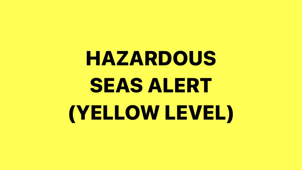 UPDATE (13/03/24): The Met Office is advising that Northerly long period swells have been observed and are currently affecting the coastlines of Trinidad and Tobago. While the effect is not continuous, the occasional battering waves will continue to occur. The Trinidad and Tobago Meteorological Service (TTMS) has issued a Hazardous Seas Alert (Yellow Level) from 2:00 PM on Tuesday (12th March, 2024) until 8:30 AM on Friday (15th March, 2024) for Northern-exposed coastlines of Trinidad and Tobago.
According to the Met Office, Northerly long period swells are expected to affect the coastlines of Trinidad and Tobago. While the effect will not be continuous over the period, the presence of Spring Tides will amplify the effect, resulting in occasional battering coastal waves, especially during High Tides. All marine interests should monitor near-shore/coastal sea conditions, exercise caution along affected areas and avoid marine activities. Please continue to pay attention to the latest forecasts, alerts, and information issued by the TTMS. This is a developing story - refresh this page for updates.  According to the Trinidad and Tobago Meteorological Service (TTMS), the North Atlantic high pressure is expected to remain strong and consistent over the next few days. With a long and straight fetch across the equatorial Atlantic, the Lesser Antilles and Trinidad and Tobago are likely to experience breezy conditions, and windy at times in some areas.
Generally fair, sunny and breezy conditions are expected across Trinidad and Tobago for this outlook period. Patches of moisture advection, together with some surface convergence, interacting with the local topography, is likely to produce brief, light or moderate showers over varying areas, with a chance for an isolated heavy shower to occur, especially near hilly areas. On the synoptic scale, no major precipitation event or significant rainfall accumulation is predicted, but with intermittent patches of moisture advection interacting with the land topography and local dynamics, there is the possibility for isolated, moderate or heavy showers to develop, especially near hilly areas. Saharan dust concentration in the atmosphere is expected to be mostly mild, being moderate at times. Bush fires have been observed, and together with the possibility for landfill and forest fires, these will likely contribute to the reduction in air quality. Sensitive persons are still advised to continue to take the necessary precautions. The Met Office has provided the following 5-day weather outlook for T&T: Saturday (9th March, 2024)
Sunday (10th March, 2024)
Monday (11th March, 2024)
Tuesday (12th March, 2024)
Wednesday (13th March, 2024)
Please continue to pay attention to the latest forecasts, alerts, and information issued by the TTMS. 
As the 2024 Dry Season conditions continue, the Water and Sewerage Authority (WASA) said it is working with the national community to provide the necessary relief. In light of this, temporary water supply schedules are now available, effective from Monday 4th March, 2024.
View the water supply schedules for South-East Trinidad below:
WASA will publish water supply schedules for other areas as they become available.
Please be guided accordingly. 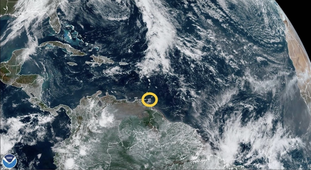
As the 2024 Dry Season conditions continue, the Water and Sewerage Authority (WASA) said it is working with the national community to provide the necessary relief. In light of this, temporary water supply schedules are now available, effective from Monday 4th March, 2024.
View the water supply schedules for North-East Trinidad below:
WASA will publish water supply schedules for other areas as they become available.
Please be guided accordingly.  According to the Trinidad and Tobago Meteorological Service (TTMS), an area of low pressure to the Northeast of the Lesser Antilles, while it is expected to be dissipating into a trough over the next few days, is likely to induce some perturbations across the equatorial Atlantic, towards the Lesser Antilles. This is likely to cause some surface convergence across the Lesser Antilles during this outlook period.
An increase in the near-surface to mid-level (2,000 ft – 8,000 ft) wind speed to moderate, and intermittently strong, is expected during this outlook period. This can, at times, translate downward to the surface and produce windy or gusty conditions, especially in elevated areas or in the vicinity of any shower that might occur. Mostly fair, sunny and breezy conditions are expected across Trinidad and Tobago for this outlook period. A few patches of moisture advection, together with weak surface convergence, interacting with the local topography, is likely to produce brief, light or moderate showers over varying areas, with a low chance for an isolated heavy shower to occur, especially near hilly areas. No major precipitation event or significant rainfall accumulation on the synoptic scale is predicted, but with intermittent patches of moisture advection interacting with the land topography and local dynamics, there is the possibility for isolated, moderate or heavy showers to develop, especially near hilly areas. Wednesday (6th March, 2024) night into Thursday morning, due to an increase in moisture convergence, the chances are heightened for the development of a few heavy showers or a thunderstorm over the near-Eastern offshore areas of Trinidad and Tobago and Southwestern Trinidad. Saharan dust concentration in the atmosphere is expected to be mostly mild, becoming mild to moderate at times, from Thursday (7th March, 2024). Bush fires have also been observed, and together with the possibility for landfill and forest fires, these will likely contribute to the reduction in air quality. Sensitive persons are still advised to continue to take the necessary precautions. The Met Office has provided the following 5-day weather outlook for T&T: Tuesday (5th March, 2024)
Wednesday (6th March, 2024)
Thursday (7th March, 2024)
Friday (8th March, 2024)
Saturday (9th March, 2024)
Please continue to pay attention to the latest forecasts, alerts, and information issued by the TTMS.  According to the Trinidad and Tobago Meteorological Service (TTMS), the North Atlantic high pressure cell remains consistent over the subtropical Atlantic. There is an area of low pressure to the Northeast of the Lesser Antilles, together with a trough to the East-Northeast, which is likely to cause the winds on the equatorial side of the high pressure to approach Trinidad and Tobago and the Lesser Antilles from the Northeast, until Monday (4th March, 2024). This can cause some wind and moisture convergence across the Lesser Antilles during this outlook period.
Mostly fair, sunny and breezy conditions with a slight haze are expected across Trinidad and Tobago for this outlook period, except for intermittent patches of moisture advection, interacting with the local topography, to produce brief, light or moderate showers over varying areas, and the low chance for an isolated heavy shower to occur, especially near hilly areas. Despite the interruptions of weak perturbations across the equatorial Atlantic, the surface wind is expected to continue to be steady throughout the outlook period. No major precipitation event or significant rainfall accumulation on the synoptic scale is predicted, but with intermittent patches of moisture advection interacting with the land topography and local dynamics, there is the possibility for isolated, moderate or heavy showers to develop, especially near hilly areas. Saharan dust concentration in the atmosphere is presently mostly mild, becoming occasionally mild to moderate towards the end of this outlook period. Bush fires are also being observed, and together with the possibility for landfill and forest fires, these will likely contribute to the reduction in the air quality. Sensitive persons are still advised to continue to take the necessary precautions. The Met Office has provided the following 5-day weather outlook for T&T: Saturday (2nd March, 2024)
Sunday (3rd March, 2024)
Monday (4th March, 2024)
Tuesday (5th March, 2024)
Wednesday (6th March, 2024)
Please continue to pay attention to the latest forecasts, alerts, and information issued by the TTMS.  According to the Trinidad and Tobago Meteorological Service (TTMS), the North Atlantic high pressure cells continue to produce mostly ridging of high pressure across Trinidad and Tobago and the Windward Islands. Due to the passing of a frontal system to the North, there is expected to be an increase in moisture convergence over the Leeward Islands between Wednesday (28th February, 2024) and Friday (1st March, 2024).
While there is likely to be an increase in moisture advection and convergence across the Lesser Antilles, mostly fair, sunny and breezy conditions with a slight haze are expected across Trinidad and Tobago for this outlook period, with intermittent patches of clouds, producing brief, light or moderate showers over varying areas, and the low chance for an isolated heavy shower to occur, especially near hilly areas. No major precipitation event or significant rainfall accumulations on the synoptic scale is predicted, but in interactions with the land topography and local dynamics, there is the possibility for isolated, moderate or heavy showers to develop, especially near hilly areas. A long and relatively uninterrupted fetch across the equatorial Atlantic is expected to remain throughout the outlook period, therefore, winds are likely to continue to be steady. Saharan dust concentration in the atmosphere is presently mostly mild, occasionally moderate, with a continuing reduction to mild concentrations from Wednesday (28th February, 2024), and for the remainder of this outlook period. Sensitive persons are still advised to continue to take the necessary precautions. The Met Office has provided the following 5-day weather outlook for T&T: Wednesday (28th February, 2024)
Thursday (29th February, 2024)
Friday (1st March, 2024)
Saturday (2nd March, 2024)
Sunday (3rd March, 2024)
Please continue to pay attention to the latest forecasts, alerts, and information issued by the TTMS. 
According to the Environmental Management Authority (EMA), the Air Quality Index (AQI) has registered as MODERATE at its Monitoring Stations in Point Lisas, Mayaro, Port-of-Spain, San Fernando and Arima, at 4:00 PM this afternoon (Monday 26th February, 2024).
Who Should be Worried?
What Should I Do?
On Sunday morning (25th February, 2024), the air quality level registered as UNHEALTHY on the AQI at the EMA's Monitoring Station in San Fernando at 11:00 AM. Meanwhile, also on Sunday, readings taken at Monitoring Stations in Arima, Mayaro, Point Lisas and Port-of-Spain registered as UNHEALTHY FOR SENSITIVE GROUPS at 11:00 AM. The recent increase in Particulate Matter (PM) is attributed to Saharan dust.
The Air Quality Monitoring Network
The EMA, through the National Ambient Air Quality Monitoring Network has been obtaining accurate, real-time assessment of ambient air quality at strategic points nationally. The Air Quality Index (AQI) is a number used by Government agencies to communicate to the public how polluted the air currently is, or how polluted it is forecast to become. As the AQI rises, an increasingly large percentage of the population is likely to experience severe adverse health effects. There are currently six (6) Ambient Air Quality Monitoring stations in Trinidad and Tobago. Five (5) are located in Trinidad (Mayaro, Arima, Port-of-Spain, Point Lisas and San Fernando) and the sixth station is located at Signal Hill, Tobago. Members of the public are advised to visit the EMA's website and social media pages for daily updates on air quality in Trinidad and Tobago. Real time updates on air quality can also be accessed via this link: https://ei.weblakes.com/RTTPublic/DshBrdAQI. Please be guided accordingly. |
AboutYouthere1 is a website focused on providing useful information, breaking news, entertainment and online shopping in Trinidad and Tobago.
AlertsSupportYouTubeContactPrivacyCategories
All
Archives
March 2024
|
 RSS Feed
