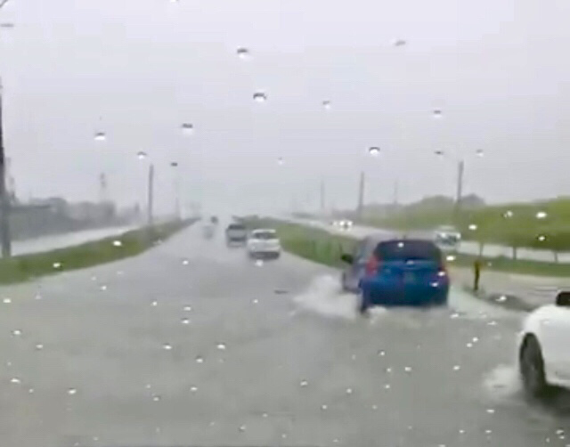
UPDATE (1:05pm): The Southbound lane of the Solomon Hochoy Highway is flooded near Freeport.
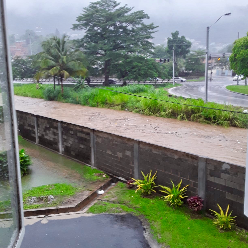
UPDATE (12:45pm): The Diego Martin River is currently at its threshold as heavy rains countinue.
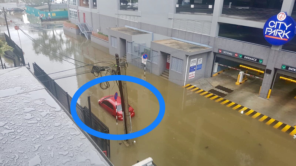
UPDATE (12:25pm): Flooding has begun on the Chagaunas Main Road as Tropical Storm Karen moves over the Island.
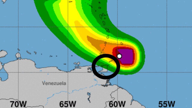
UPDATE (11am): The center of Tropical Storm Karen is currently located near Latitude 12.5 North and Longitude 61.7 West. Karen is moving toward the West-Northwest near 13 Mph (20 Km/h) and this general motion is expected to continue today. A turn toward the Northwest is forecast to occur on Monday, followed by a turn toward the North on Tuesday.
On the Forecast Track, the center of Karen will move away from the Windward Islands later today, and then across the Eastern Caribbean Sea tonight and Monday. On Tuesday, Karen is expected to approach Puerto Rico and the Virgin Islands. Maximum sustained winds are near 40 Mph (65 Km/h) with higher gusts. Little change in strength is forecast during the next 48 hours. 
UPDATE (10:15am): The Minister of National Security is assuring citizens that Tropical Storm Karen is being closely monitored. The Office of Disaster Preparedness and Management (ODPM) and the Met Office are co-ordinating with key Stakeholders such as the Protective Services and several Ministries.
UPDATE: The Met Office has also issued a Red Level Alert for this Tropical Storm.
Tropical Storm Warnings have been issued for Trinidad & Tobago, Grenada and its Dependencies as the approaching strong Tropical Wave was upgraded to Tropical Storm Karen at 5am on Sunday 22nd September 2019. A Tropical Storm Warning means that Tropical Storm conditions are expected somewhere within the warning area, in this case within the next 12 hours.
Tropical Storm Karen is expected to move across Trinidad & Tobago later this morning (Sunday 22nd September 2019) and emerge over the South-Eastern Caribbean Sea by Monday morning. As of 5am this morning, the center of Karen was located approximately 80 Km Northeast of Tobago.
Tropical Storm Warnings may be issued later today for other portions of the Windward Islands. A Tropical Storm Watch will likely be issued later today for Puerto Rico and the Virgin Islands. Elsewhere, interests in the Leeward Islands should monitor the progress of Karen.
See the Tropical Storm Advisory from the Met Office below and stay tuned for important weather updates. 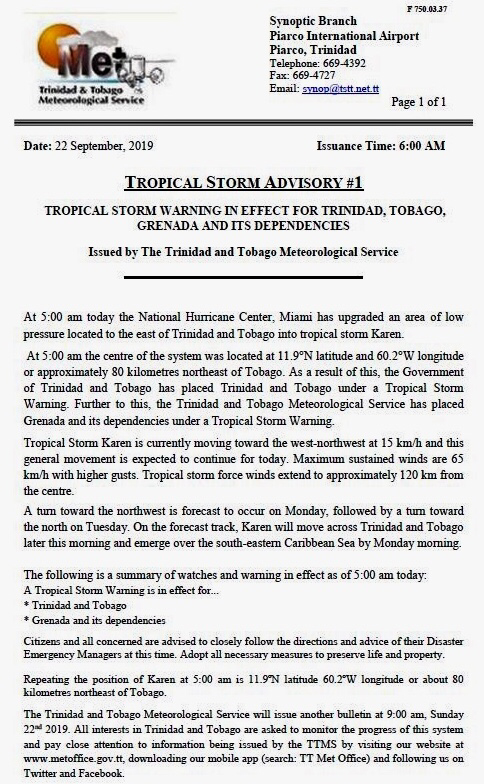


0 Comments
Leave a Reply. |
AboutYouthere1 is a website focused on providing useful information, breaking news, entertainment and online shopping in Trinidad and Tobago.
AlertsSupportYouTubeContactPrivacyCategories
All
Archives
March 2024
|
 RSS Feed
