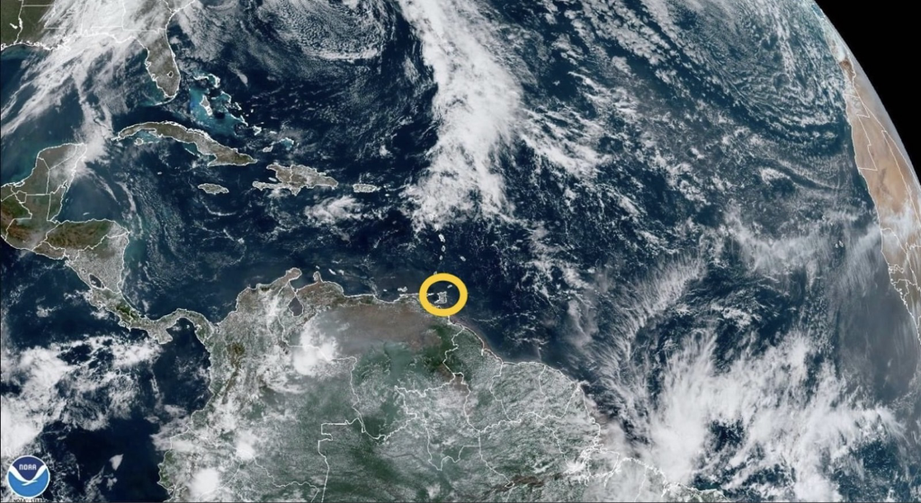
 The Trinidad and Tobago Meteorological Service (TTMS) has issued a High Wind Alert (Yellow Level) for a total of thirteen (13) hours. The Alert begins at 11pm tonight (Sunday 15th May 2022) and will remain in effect until 12pm tomorrow (Monday 16th May 2022).
Following the passage of the first Tropical Wave of 2022 into tonight, a wind surge is expected, which will increase the instability of the atmosphere even more. According to the Met Office, relatively strong low-level winds are forecast overnight into tomorrow morning and there is a high (70%) chance of isolated wind gust events in excess of 55 Km/h towards Midnight into tomorrow morning. Such wind gusts may be brief but capable of displacing poorly secured roofs, loose outdoor objects as well as breaking off tree branches. Marine small crafts can be adversely impacted by these strong winds and visibility may be extremely low during dusk and dawn. Wind waves occasionally can reach up to 2.5m in open waters and may become choppy in sheltered areas. Citizens are advised to secure loose outdoor objects and livestock. Marine interests should also exercise extra caution during this period. This is a developing story - refresh this page for updates.
0 Comments
Leave a Reply. |
AboutYouthere1 is a website focused on providing useful information, breaking news, entertainment and online shopping in Trinidad and Tobago.
AlertsSupportYouTubeContactPrivacyCategories
All
Archives
March 2024
|
 RSS Feed
